Rabu, 07 Juli 2010

Adios El Niño, Hello La Niña?

Adios El Niño, Hello La Niña?
06.22.10
latest data from the NASA/European Ocean Surface Topography Mission/Jason-2 satelliteThe latest data from the NASA/European Ocean Surface Topography Mission/Jason-2 satellite show that the tropical Pacific has switched from warm, or higher-than-normal sea surface heights (shown in red) to cold, or lower-than-normal sea surface heights (shown in blue) during the last few months. Image Credit: NASA/JPL Ocean Surface Topography Team
› Full image and caption

The latest image of Pacific Ocean sea surface heights from the NASA/European Ocean Surface Topography Mission/Jason-2 oceanography satellite, dated June 11, 2010, shows that the tropical Pacific has switched from warm (red) to cold (blue) during the last few months. The blue area in the center of the image depicts the recent appearance of cold water hugging the equator, which the satellite measures as a region of lower-than-normal sea level. Remnants of the El Niño warm water pool, shown here in red and yellow, still linger north and south of the equator in the center of the image.

The image shows sea surface height relative to normal ocean conditions. Red (warmer) areas are about 10 centimeters (4 inches) above normal. Green areas indicate near-normal conditions. Purple (cooler) areas are 14 to 18 centimeters (6 to 7 inches) below normal. Blue areas are 5 to 13 centimeters (2 to 5 inches) below normal.

"The central equatorial Pacific Ocean could stay colder than normal into summer and beyond. That's because sea level is already about 10 centimeters (4 inches) below normal, creating a significant deficit of the heat stored in the upper ocean," said JPL oceanographer and climatologist Bill Patzert. "The next few months will reveal if the current cooling trend will eventually evolve into a long-lasting La Niña situation."

A La Niña is essentially the opposite of an El Niño. During a La Niña, trade winds in the western equatorial Pacific are stronger than normal, and the cold water that normally exists along the coast of South America extends to the central equatorial Pacific. La Niñas change global weather patterns and are associated with less moisture in the air, resulting in less rain along the coasts of North and South America. They also tend to increase the formation of tropical storms in the Atlantic.

"For the American Southwest, La Niñas usually bring a dry winter, not good news for a region that has experienced normal rain and snowpack only once in the past five winters," said Patzert.

For more information on El Niño, La Niña and Jason-2, visit: http://sealevel.jpl.nasa.gov

Alan Buis
818-354-0880
alan.buis@jpl.nasa.gov

UN Reports End To El Niño Pattern Over The Pacific

UN Reports End To El Niño Pattern Over The Pacific

UN Meteorological Agency Reports End To El Niño Pattern Over The Pacific

New York, Jul 6 2010 2:10PM
The weather pattern known as El Niño rapidly dissipated in early May, giving way to the development of cool, neutral to weak La Niña conditions in the tropical Pacific Ocean, the United Nations World Meteorological Organization (WMO) reported today.

El Niño refers to an abnormal warming of surface ocean waters in the eastern tropical Pacific, while La Niña is characterized by unusually cool ocean temperatures in the eastern equatorial Pacific. Both events can disrupt the normal patterns of tropical precipitation and atmospheric circulation, and have widespread impacts on climate in many parts of the world.

The prevailing conditions are more likely than not to strengthen into a basin-wide La Niña over the coming months, according to the El Niño/La Niña update issued by WMO.

By mid-June, the sea-surface temperatures had decreased to approximately 0.5 degrees Celsius below normal over the central and eastern equatorial Pacific, near the borderline of La Niña conditions.

Further, below average sea temperatures exist beneath the surface of the central and eastern equatorial Pacific. Forecast models continue to predict further decreases in the central and eastern Equatorial Pacific sea-surface temperature. In particular, most dynamic models strongly favour further La Niña development, according to WMO.

While it is likely that La Niña conditions will further develop in the next several months, the timing and magnitude of such an event in 2010 are as yet uncertain, with no indications at this time of a particularly strong event in terms of sea-surface temperatures.

The unusual climate patterns and extremes that occur in association with La Niña conditions also occur independently of La Niña, and therefore individual users of climate information should seek detailed interpretation for their locations and sectors, WMO said in the update.

Over the coming months, the climate forecasting community will provide detailed interpretations of regional climate conditions through the National Meteorological and Hydrological Services, it added.

http://www.scoop.co.nz/stories/WO1007/S00115.htm

Seks Bebas Karena Orang Kurang Kerjaan

Rabu, 30/06/2010 18:14 WIB

Dokter: Seks Bebas Karena Orang Kurang Kerjaan

AN Uyung Pramudiarja - detikHealth


img
Ilustrasi (foto: getty images)
Jakarta, Perilaku seks bebas di tanah air terus menunjukkan peningkatan. Komisi Penanggulangan AIDS pun dibuat cemas karena perilaku seks bebas yang rawan menularkanpenyakit termasuk HIV.

Tidak bisa dipungkiri, banyak generasi muda mulai terjerumus ke dalam perilaku tersebut saat menganggur.
Sekretaris Eksekutif dari Komisi Penanggulangan AIDS, Dr Nafsiah Mboi, MPH mengatakan sebagian besar remaja memulai seks dengan kondisi tidak ada kegiatan.

Dimulai dari rasa ingin tahu yang tiba-tiba muncul, kemudian iseng mencobanya. "Menurut peneltian, sebagian remaja memulai seks karena mereka menganggur, kemudian iseng," ungkap Dr Naf dalam jumpa pers di Komisi Penanggulangan AIDS, Jakarta, Rabu (30/6/2010.

Menurutnya, jika remaja banyak mengisi waktunya dengan kegiatan positif maka pikiran untuk melakukan seks bebas bisa diminimalkan. Menekuni hobi dan kegiatan lain yang positif bisa menghindarkan remaja dari perilaku seks bebas.

Dr Naf tidak menganjurkan pendidikan seks dipaksakan ketika seorang remaja masih menekuni sesuatu. Sebab selama anak tersebut aktif, maka kecil kemungkinannya untuk memikirkan seks.

"Kalau anak punya hobi, biarkan saja, semua ada masanya kok. Jangan dulu ngomong seks atau mikir seks," tambahnya.

Oleh karena itu untuk mencegah seks bebas, ia menganjurkan anak remaja untuk menekuni hobinya. Menurutnya, semua pihak harus memberi kesempatan bagi generasi muda untuk banyak berolahraga, berkreativitas dan melakukan kegiatan positif lainnya.

Seks bebas menimbulkan sedikitnya
10 penyakit seperti:

1. Herpes Genital
2. Sifilis (Penyakit Raja Singa)
3. Gonore (Kencing Nanah)
4. Klamidia
5. Jengger Ayam atau Kutil di kelamin (Genital wart)
6. Hepatitis B
7. Kanker prostat
8. Kanker Serviks (leher rahim)
9. HIV/AIDS
10. Trichomoniasis

Sangat penting mengetahui bahwa hubungan seksual bukan hanya sekedar hubungan intim. Kontak seksual seperti ciuman, oral seks dan penggunaan alat bantu seks seperti vibrator juga berisiko menularkan virus.

Satu-satunya cara untuk mencegah penyebaran dan tidak mendapatkan penyakit itu adalah dengan berhubungan seks saat waktunya dengan satu pasangan. Penggunaan kondom memang bisa mencegah penyakit HIV dan gonorrhea, tapi kurang efektif mencegah herpes, trichomoniasis, chlamydia dan HPV.

Dalam kesempatan itu ia juga memperkenalkan
sexxie.tv, sebuah situs internet bertujuan untuk memberi pendidikan seks pada remaja. Dalam situs tersebut, remaja dapat melakukan chatting langsung dengan para pakar maupun mengikuti seminar online yang disebut webminar.

Situs interaktif tersebut digagas oleh Dr Wei Siang Yu, dokter asal Singapura yang juga menciptakan program TV edutainment
Love Airways. Saat ini sudah ada 6 dokter terlibat dalam proyek tersebut, dan tersebar di Indonesia, Singapura, Malaysia dan Filipina.
(
up/ir)


Magnitude 5.1 SOUTHEAST OF LOYALTY ISLANDS

Historic Seismicity

Magnitude 5.1 SOUTHEAST OF LOYALTY ISLANDS
Tuesday, July 06, 2010 at 16:38:07 UTC

Historic SeismicityWorld Location
Magnitude / Depth Legend
Major Tectonic Boundaries: Subduction Zones -purple, Ridges -red and Transform Faults -green


Seismicity in 2010
Magnitude / Depth Legend
Major Tectonic Boundaries: Subduction Zones -purple, Ridges -red and Transform Faults -green


Magnitude 7 and Greater Earthquakes
Magnitude / Depth Legend
Major Tectonic Boundaries: Subduction Zones -purple, Ridges -red and Transform Faults -green


Preliminary Earthquake Report
U.S. Geological Survey, National Earthquake Information Center
World Data Center for Seismology, Denver

http://neic.usgs.gov/neis/bulletin/neic_yja9_h.html

SOUTHEAST OF THE LOYALTY ISLANDS

Magnitude 5.2 - SOUTHEAST OF THE LOYALTY ISLANDS

2010 July 06 16:38:07 UTC

  • This event has been reviewed by a seismologist.
Magnitude5.2
Date-Time
  • Tuesday, July 06, 2010 at 16:38:07 UTC
  • Wednesday, July 07, 2010 at 03:38:07 AM at epicenter
Location22.405°S, 171.766°E
Depth146.9 km (91.3 miles)
RegionSOUTHEAST OF THE LOYALTY ISLANDS
Distances30 km (20 miles) W of Ile Hunter, Loyalty Isl., New Caledonia
300 km (185 miles) WSW of Ceva-i-Ra, Fiji
550 km (340 miles) E of NOUMEA, New Caledonia
1635 km (1010 miles) N of Auckland, New Zealand
Location Uncertaintyhorizontal +/- 12.2 km (7.6 miles); depth +/- 26.7 km (16.6 miles)
ParametersNST= 23, Nph= 23, Dmin=836.6 km, Rmss=0.99 sec, Gp=112°,
M-type=body wave magnitude (Mb), Version=6
Source
  • USGS NEIC (WDCS-D)
Event IDus2010yja9

Selasa, 06 Juli 2010

The Most Expensive Home Insurance Perils

The Most Expensive Home Insurance Perils

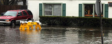
Flooded home. (Darren McCollester/Getty Images)

Michael Sanibel , Investopedia.com
Jul 1, 2010

Depending on where you live in the United States, your home may be at risk to a number of natural disasters that could damage or destroy it. Beyond that, a lifetime of memories and irreplaceable items inside your home may be even harder to lose than the house itself. Insurance affords some protection against these threats, and the rate you pay will be a function of where you live.

According to Flora Richards-Gustafson of Rapid Refile, the following are the most significant risks to homeowners due to natural disasters:

More from Investopedia

» 10 Ways To Prepare For Nature's Worst

» 4 Overlooked Homeownership Costs

» 10 Insurance Tips For Homeowners

Northeast - Severe Winter Storms
In addition to knocking out power and paralyzing homes and businesses, these storms often cause significant water damage in two ways. First, pipes may burst due to cold temperatures. Second, the snowmelt in the spring may overflow rivers and reservoirs.

South (including Atlantic and Gulf Coasts) - Hurricanes
The season runs for six months starting on June 1, and may feature many tropical storms that never reach hurricane strength. High wind damage and flooding from heavy rains are the major risks.

Midwest (including Great Plains) - Tornadoes
In addition to the risk of wind damage and flooding, tornadoes often cause fires when they rupture and destroy gas and power lines. Flooding is also caused in these areas when heavy rainfall and snowmelt overwhelm a land mass that is normally relatively dry. Swollen rivers and broken levees in low-lying areas are a continuous threat.

West Coast - Earthquakes and Wildfires
This area has the most active faults, and a significant quake has a ripple effect that may result in flooding, fires, collapsing structures and power loss.

The region is also prone to wildfires, due to the prevalence of dry brush and desert-like conditions. Wildfires are often accompanied and fueled by high winds that further compound the damage.

Financial Impact
The chart below ranks homeowners insurance claims by frequency and provides the average size of each type of claim. It is based on the weighted average of homeowner losses from 2003-2007 for multiple peril policies (excluding tenants and condominium owners).

Cause of loss and type of coverage (a)Claim frequency (b)Claim severity (c)
Wind and hail (property damage)2.13$7,163
Water damage and freezing (property damage)1.42$5,531
All other property damage (d)1.06$3,532
Fire, lightning and debris removal (property damage)0.52$24,153
Theft (property damage)0.50$2,494
Bodily injury and property damage (liability)0.14$15,854

(a) Types of homeowners coverages are property damage and liability
(b) Claims per 100 house years (policies)
(c) Accident year incurred losses, excluding loss adjustment expenses (indemnity costs per accident year incurred claims)
(d) Includes vandalism and malicious mischief

Chart provided by Insurance Information Institute (Source: Insurance Services Office, Inc.)

Flooding
During the past decade, the Federal Emergency Management Agency has declared an average of 56 disasters per year. Of the 59 disasters declared in 2009, 41 involved flooding primarily caused by severe storms and tornadoes. In spite of this compelling statistic, Geoff Gordon, owner and president of Andrew G. Gordon Insurance, says that "there is one large peril where insurance is readily available, but consumers choose to ignore - flood insurance."

The National Flood Insurance Program subsidizes flood policies through participating companies, but Gordon says that "too many consumers choose to self-insure this risk." From his vantage point in the northeast, he views this as "incredible behavior since the chances of a flood are much greater than the chances of a hurricane."

Water Damage
In most areas of the country, the risk of a serious water leak exceeds the risk of a naturally caused flood. According to Todd Triano, vice president for Chartis Insurance, "the most commonly reported homeowner claim in my experience is water damage. For example, a pipe may burst inside the wall or a hot water heater on an upper level can leak and cause significant damage to the building and personal property."

To assist homeowners to protect themselves, Triano notes that "plumbing products have surfaced in the marketplace to help homeowners monitor their water usage and/or shut off the water completely if a leak is discovered by smart sensors." Homeowners can also purchase "smart sump pumps" that email or send a text message when the power goes out, alerting the owners to check and engage a backup sump pump.

The Bottom Line
While there are many natural perils facing homeowners around the country, the most common damage is caused by wind and water. Whether it's a hurricane, a tornado, a dam cracked by an earthquake or a broken pipe, the end result can be a destroyed or severely-damaged home.

http://realestate.yahoo.com/promo/the-most-expensive-home-insurance-perils