Tampilkan postingan dengan label U.S. National Hurricane Center said. Tampilkan semua postingan

Senin, 31 Agustus 2009

Category 4 hurricane threatens Mexico's

Category 4 hurricane threatens

Mexico's west coast


People gather at a beach in Cabo San Lucas, Baja California peninsula,AP – People gather at a beach in Cabo San Lucas, Baja California peninsula, northwestern Mexico, Sunday, Aug. …

CABO SAN LUCAS, Mexico – Emergency workers built shelters for thousands of endangered families as a strengthening Hurricane Jimenaroared toward Mexico's resort-studded Baja California peninsulaMonday.

Jimena, a dangerous Category 4 storm, could rake southern Baja California by Tuesday evening, forecasters said.

At least 10,000 families will be evacuated from potential flood zones, said Francisco Cota, the local director of Civil Protection. He said 60 shelters would be set up.

"I think it's going to be a substantial hurricane by the time it approaches," said Richard Pasch of the National Hurricane Center in Miami.

Delegates from around the world had already begun to arrive for a conference sponsored by the Organization of Economic Cooperation and Development on Tuesday and Wednesday at Cabo Los Cabos at the southern tip of the peninsula.

Nicholas Bray, the head of media for the Paris-based organization, said Monday there are no plans to postpone or cancel the meeting due to the hurricane.

Brenda Munoz, who lost her home to a 2001 hurricane, was taking no chances and stocking up on food this time.

"I remember when Hurricane Juliette hit with a lot of intensity. It flattened our home, lots of flooding, lots of disaster," Munoz said in Cabo San Lucas. "We're already prepared with food and everything so it won't catch us off guard."

But with the weather still mild on Sunday, Jim Patterson, a tourist fromBig Bear Lake, California, could not muster much concern.

"Are you saying it would be a good idea to stock up on tequila?" he joked at a seaside restaurant. "No fear. I've been through tornados and earthquakes and everything else, but never a hurricane."

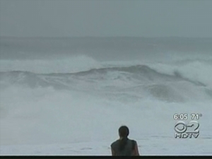
Farther south, Jimena kicked up surf along Mexico's mainland western coast and generated strong winds that bent and uprooted trees in the resort town of Zihuatanejo.

Early Monday, Jimena had maximum sustained winds near 145 mph (230 kph) and was moving northwest near 8 mph (13 kph).

It was centered about 370 miles (595 kilometers) south-southeast of Cabo San Lucas.

Authorities in Cabo Corrientes were setting up shelters in case of heavier winds and rain, said Arturo Garcia, an official with Jalisco's Civil Protection agency.

The U.S. hurricane center issued a public advisory for residents in western Mexico and the southern part of the Baja peninsula to keep tabs on Jimena.

Farther out in the Pacific, a weakening Tropical Storm Kevin had top winds of 40 mph (65 kph) and was centered 895 miles (1,435 kilometers) west-southwest of the Baja peninsula's southern tip.

http://news.yahoo.com/s/ap/20090831/ap_on_re_la_am_ca/tropical_weather

Senin, 17 Agustus 2009

Hurricane Bill on Atlantic

Hurricane Bill on Atlantic track toward Bermuda


MIAMI (Reuters) – Hurricane Bill, the first hurricane of the 2009 Atlantic season, gained strength quickly as it churned across open ocean on Monday in the direction of Bermuda, the U.S. National Hurricane Center said.

Two other tropical cyclones, Ana and Claudette, were fading; Ana in the Caribbean Sea just south of Puerto Rico, and Claudette in the southern United States after slogging ashore on the Florida panhandle.

Bill's top winds reached 90 miles per hour (145 kilometers per hour), just below Category 2 on the Saffir-Simpson scale of hurricane intensity, the Miami-based hurricane center said. Forecastersexpected it to hit Category 3, with winds of more than 110 mph by late Tuesday or early Wednesday.

Category 3, 4 and 5 storms are considered "major" hurricanes, the most destructive type.

Bill was about 1,080 miles east of the Lesser Antilles at 11 a.m. EDT (1500 GMT) and was charging to the west-northwest at 16 mph, the hurricane center said.

On its most likely track, Bill would move well north of the northernmost Caribbean islands toward the U.S. East Coast, forecasters said. The hurricane center's long-range track showed it southwest of Bermuda by Saturday morning.

Tropical Storm Claudette hit the U.S. Gulf of Mexico coast near Fort Walton Beach in the Florida panhandle early on Monday and quickly weakened to a tropical depression as it moved over southern Alabama.

Florida emergency managers reported sporadic power outages but no widespread damage. They cautioned residents to watch for rising rivers and flooding in low-lying areas.

CLAUDETTE MISSES ENERGY FACILITIES

Claudette, which sprouted with surprising speed on Sunday in the eastern Gulf of Mexico, missed the largest concentration of U.S. oil and gas production platforms, which stretch along the coast from Mobile Bay, Alabama, to Brownsville, Texas.

The Gulf is home to almost half of U.S. refinery capacity, a quarter of oil production and 15 percent of natural gas output.

Tropical Depression Ana doused Puerto Rico with heavy rain on Monday as it charged through the Caribbean Sea to the west-northwest at a brisk 28 mph, the hurricane center said.

It was located about 75 miles south of San Juan Puerto Rico and had top winds of 35 mph, forecasters said.

A tropical storm watch was in effect for Puerto Rico, the U.S. and British Virgin Islands and parts of theDominican Republic, although forecasters said Ana could degenerate further on Monday.

NHC website: http://www.nhc.noaa.gov/

(Additional reporting by Scott DiSavino in New York; editing by Pascal Fletcher and Phil Stewart)

http://news.yahoo.com/s/nm/20090817/us_nm/us_weather_st0rms