Tampilkan postingan dengan label East Coast. Tampilkan semua postingan

Jumat, 26 Agustus 2011

Hurricane Irene interactive: East Coast braces for impact

Hurricane Irene interactive: East Coast braces for impact

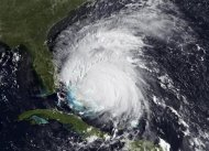
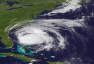
A large and powerful Category 3 storm with winds of 115 mph roared through the Bahamas and is now making its way toward the eastern seaboard. Millions of people from North Carolina to New England are bracing for Hurricane Irene, which is expected to move up the coast starting this weekend. The storm has already been responsible for at least three deaths, one in Puerto Rico and two in the Dominican Republic.


http://news.yahoo.com/blogs/newsroom/hurricane-irene-interactive-east-coast-braces-impact-200535720.html

Take a look at this AP interactive for more information:


East Coast braces for Irene

East Coast braces for Irene

WILMINGTON, North Carolina (Reuters) - As North Carolina braced on Friday for a direct hit from Hurricane Irene, cities along the East Coast were on alert and millions of beach goers cut short vacations to escape the powerful storm.

With more than 50 million people potentially in Irene's path, residents stocked up on food and water and worked to secure homes, vehicles and boats. States, cities, ports, oil refineries and nuclear plants scrambled to activate emergency plans.

"I filled my tank up with gas in case I need to leave in a hurry or something, and get a lot of food supplies, taking everything out of my yard ... anything that can fly into a window," said Patricia Stapleton of Newport, North Carolina.

Irene lashed the low-lying Bahamas on Thursday and was expected to hit North Carolina on Saturday before heading up the coast to New York and beyond.

Irene weakened slightly early on Friday -- to a Category 2 hurricane from a Category 3 on the five-step Saffir-Simpson scale -- but still was packing winds of up to 110 miles per hour (175 km per hour).

At 5 a.m. EDT, its center was about 420 miles south-southwest of Cape Hatteras, North Carolina.

"Some re-intensification is possible today and Irene is expected to be near the threshold between Category Two and Three as it reaches the North Carolina coast," the U.S. National Hurricane Center said.

Coastal evacuations were under way in North Carolina and were ordered for beach resorts in Virginia, Delaware and Maryland. Airlines began to cut flights at eastern airports, made plans to move aircraft from the region and encouraged travelers to consider postponing trips.

"All the major metropolitan areas along the northeast are going to be impacted," National Hurricane Center Director Bill Read told Reuters Insider. "Being a large hurricane, tropical storm-force winds will extend far inland."

'HORRENDOUS DAY FOR TRAVEL'

Virginia Governor Bob McDonnell urged residents to seek shelter by Friday night, before the winds kick up.

"Saturday is going to be a horrendous day for travel. There will be roads and bridges closed," he said.

Anticipating severe storm damage in North Carolina, U.S. President Barack Obama declared an emergency on Thursday, authorizing federal aid to support that state's response. The governors of North Carolina, Virginia, Maryland, Delaware, New Jersey, New York and Connecticut also declared emergencies.

Even if the center of Irene stays offshore as it tracks up the coast, its heavy winds and rain could lash cities like Washington, Baltimore, Philadelphia and New York and knock out power, forecasters said.

Irene will be the first hurricane to hit the U.S. mainland since Ike pounded Texas in 2008.

New York Mayor Michael Bloomberg said the most populous U.S. city was bracing for storm conditions and flooding starting on Sunday.

He urged residents of vulnerable areas to move to safety on Friday because the mass transit system, the nation's biggest with 8 million passengers a day, may have to shut if flooding or high winds endanger its buses, subways and commuter trains.

Many New Yorkers do not have cars, so mass transit could be vital in evacuations.

Long Island, the populous area that extends about 100 miles east into the Atlantic Ocean from New York City, could be hit hard if Irene stays on its current track.

In Washington, Irene forced the postponement of Sunday's dedication ceremony for the new memorial honoring civil rights leader Martin Luther King Jr. Tens of thousands of people, including Obama, had been expected to attend.

Flooding from Irene killed at least one person in Puerto Rico and two in the Dominican Republic. The storm knocked out power in the Bahamian capital Nassau and blocked roadways with fallen trees.

(Reporting by Tom Brown and Manuel Rueda in Miami, Daniel Trotta and Joan Gralla in New York; Laura MacInnis and JoAnne Allen in Washington, Don Pessin in North Carolina; Writing by Philip Barbara; Editing by Christopher Wilson and John O'Callaghan)

http://news.yahoo.com/east-coast-irenes-path-scrambles-prepare-003351853.html

'Nightmare' scenario: Hurricane menaces East Coast

'Nightmare' scenario: Hurricane menaces East Coast

NAGS HEAD, N.C. (AP) — Farmer Wilson Daughtry shrugged off an evacuation order and raced to harvest all the corn and squash he could hours before the initial waves churned up by Hurricane Irene started bumping the outer islands of North Carolina. Far away in Maine, lobsterman Greg Griffin reported his colleagues were stowing traps and tying up boats, heeding forecasts of 30-foot battering waves to come.

For hundreds of miles, as many as 65 million people along the densely populated East Coast warily waited Friday for a dangerous hurricane that has the potential to inflict billions of dollars in damages anywhere within that urban sprawl that arcs from Washington and Baltimore through Philadelphia, New York, Boston and beyond.

The main thrust of Irene wasn't expected in North Carolina until sometime Saturday. But heightened waves from the storm weren't waiting, already hitting the Outer Banks early Friday where many tourists and regular islanders had packed up and left, the National Weather Service said.

Meanwhile, the hurricane warning area was expanded and now covered the coast from North Carolina up to Sandy Hook, N.J., which is just south of New York City. A hurricane watch extended even farther north and included Long Island, Martha's Vineyard and Nantucket, Mass.

Irene weakened slightly Friday, dropping down to a Category 2 storm with maximum sustained winds near 110 mph (175 kph). But some re-strengthening was possible and the storm was expected to be near the threshold between a Category 2 and 3 storm as it reached North Carolina's coast, the National Hurricane Center said.

Buxton, N.C. real estate agent Danny Couch owns a bus tour business on Hatteras Island and worries about Irene's damage potential in unexpected ways. Not the Cape Hatteras Lighthouse or other icons of the Outer Banks, but N.C. Highway 12, the two-lane road that runs up and down the vulnerable barrier island.

That's a lifeline for the community, along with the aged Bonner Bridge, the only connection to the mainland other than two ferries.

"It always the road," he said when asked what he will check when Irene passes. "That's your way in, that's your way out."

North Carolina was just first in line along the Eastern Seaboard — home to some of the nation's most heavily populated areas and some of its priciest real estate. Besides major cities, sprawling suburban bedroom communities, ports, airports, highway networks, cropland and mile after mile of built-up beachfront neighborhoods are in harm's way.

"One of my greatest nightmares was having a major hurricane go up the whole Northeast coast," Max Mayfield, the National Hurricane Center's retired director, told The Associated Press on Thursday as the storm lurched toward the U.S. "This is going to be a real challenge ... There's going to be millions of people affected."

The hurricane would be the strongest to strike the East Coast in seven years, and people were already getting out of the way. After dousing the Bahamas, it was again moving over warm Atlantic waters that will energize it.

The center of the storm was still about 420 miles (675 kilometers) south-southwest of Cape Hatteras, N.C., and moving to the north at 14 mph (22 kph).

Hundreds of thousands of New Yorkers were told Thursday to pack a bag and be prepared to move elsewhere. The nation's biggest city hasn't seen a hurricane in decades.

Farther south, tens of thousands packed up and left North Carolina beach towns and farmers pulled up their crops.

Daughtry has lost count of how many times his crops have been wiped out by storms that regularly blow up from the tropics.

"That's the price of living in paradise," he said of a fertile farm belt that's weathered an unusually hot and dry summer. Any deluge from Irene's rain bands could wipe out many crops just when they are ready for harvesting.

What's at stake in North Carolina? Latest figures show coastal North Carolina's fields earned nearly $6.3 billion in farm income in 2009 alone from its tobacco, corn and other crops.

Risks are many from Irene's wrath: surging seas, drenching rains, flash floods and high winds are all possibilities the Federal Emergency Management Agency director wasn't counting out.

"We're going to have damages, we just don't know how bad," Craig Fugate told AP as FEMA readied plans in many states. "This is one of the largest populations that will be impacted by one storm at one time."

Not just infrastructure, but jobs are also at stake.

Take Mary Thomas of Nags Head, a 34-year-old motel worker.

"We depend on tourism," said Thomas. "If we're hit, the motel will be shut down for a while. Businesses will be closed. People will have to rebuild. And that means I'll be out of a job."

The Outer Banks attracts thousands of tourists each year who stay in hotels and motels or the upscale homes lining the oceanfront. Many workers, like Thomas, earn a living by working in restaurants that cater to the tourists — and some were struggling before the storm barreled toward North Carolina.

"I just don't know what I would do if I lose my job," said Thomas, the mother of two.

Latest forecasts had Irene crashing up the North Carolina coastline Saturday, then churning up the East while drenching areas from Virginia to New York City before a much-weakened storm reaches New England.

Even if the winds aren't strong enough to damage buildings in a metropolis made largely of brick, concrete and steel, a lot of New York's subway system and other infrastructure is underground and subject to flooding in the event of an unusually strong storm surge or heavy rains, authorities noted.

New York City's two airports also are close to the water and could be inundated, as could densely packed neighborhoods, if the storm pushes ocean water into the city's waterways, officials said. The city had a brush with a tropical storm, Hanna, in 2008 that dumped 3 inches of rain in Manhattan.

All told, Irene could cause billions of dollars in damages or more along the Eastern Seaboard in a worst case scenario, said Kathleen Tierney, director of the Natural Hazards Center at the University of Colorado.

In the last 200 years, New York has seen only a few significant hurricanes. In September of 1821, a hurricane raised tides by 13 feet in an hour and flooded all of Manhattan south of Canal Street, the southernmost tip of the city. The area now includes Wall Street and the World Trade Center memorial.

New England is also unaccustomed to direct hits from hurricanes. Griffin, who fishes from Portland, Maine, still recalls the clobbering when Hurricane Gloria struck in 1985 and said this one is not one to ignore after years without a large, dangerous storm.

"We have a young generation of lobstermen who've never experienced a full-blown hurricane," Griffin warned.

The first U.S. injuries from Irene appeared to be in South Florida near West Palm Beach where eight people were washed off a jetty Thursday by a large wave churned up by the storm.

In Washington, Irene dashed hopes of dedicating a 30-foot sculpture to the late Martin Luther King Jr. on the National Mall on Sunday with the help of President Barack Obama. While a direct strike on the nation's capital appeared slim, organizers said the forecasts of wind and heavy rain made it too dangerous to summon a throng they initially expected to number up to 250,000 strong.

CoreLogic, a company that provides strategic information to businesses and others, issued a statement Thursday that its data showed some 1.8 million residential and commercial properties in the region were at potential risk to storm surge flooding. It said those properties are in 12 major coastal metropolitan areas within Irene's projected path and added Long Island, New York, faced the highest risk with nearly 388,000 properties.

Heavy rain and possible floods were big worries in the Northeast. The potential for flooding and wind damage are Irene's greatest threats to Rhode Island, still smarting from the 2010 spring floods that devastated parts of the Ocean State.

In Connecticut, Gov. Daniel P. Malloy declared a state of emergency and warned there could be prolonged power outages if Irene dumps up to a foot of rain on already saturated ground as some fear. He said emergency responders must be ready in event of any evacuations from heavily developed urban areas.

"We are a much more urban state than we were in 1938," he said, referring to the year that the so-called "Long Island Express" hurricane killed 600 people and caused major damage with 17-foot storm surges and high winds.

The urban population explosion in recent decades also worries New Jersey officials. Gov. Chris Christie encouraged anyone on that state's heavily built-up shoreline to begin preparations to leave.

Hurricanes have made landfall on New Jersey just twice in the last 200 years, in 1821 and 1903, the latter battering the Atlantic City area. But the state now has 8.8 million people and coastal areas packed with homes and businesses — and 11 major casinos in Atlantic City.

The beach community of Ocean City, Md., was taking no chances, ordering thousands of people to leave.

"This is not a time to get out the camera and sit on the beach and take pictures of the waves," said Maryland Gov. Martin O'Malley.

___

Associated Press writers Michael Biesecker in Raleigh, N.C.; Jennifer Peltz and Seth Borenstein in New York; Wayne Parry, Geoff Mulvihill and Bruce Shipkowski in New Jersey; Brock Vergakis in Virginia; Randall Chase in Ocean City, Md.; and Martha Waggoner in North Carolina contributed to this story.


http://news.yahoo.com/nightmare-scenario-hurricane-menaces-east-coast-074204359.html

Kamis, 25 Agustus 2011

Quake rocks Washington area, felt on East Coast

Quake rocks Washington area, felt on East Coast

MINERAL, Va. (AP) — The most powerful earthquake to strike the East Coast in 67 years shook buildings and rattled nerves from South Carolina to Maine on Tuesday. Frightened office workers spilled into the streets in New York, and parts of the White House, Capitol and Pentagon were evacuated.

There were no immediate reports of deaths, but fire officials in Washington said there were at least some injuries.

Click photo to view more images. (AP/Jacquelyn Martin)

Click photo to view more images. (AP/Jacquelyn Martin)

The National Cathedral said its central tower and three of its four corner spires were damaged, but the White House said advisers had told President Barack Obama there were no reports of major damage to the nation's infrastructure, including airports and nuclear facilities.

The U.S. Geological Survey said the quake registered magnitude 5.8 and was centered 40 miles northwest of Richmond, Va.

Two nuclear reactors at the North Anna Power Station, in the same county as the epicenter, were automatically taken off line by safety systems, said Roger Hannah, a spokesman for the U.S. Nuclear Regulatory Commission.

The earthquake came less than three weeks before the 10th anniversary of the Sept. 11 attacks, and in both Washington and New York it immediately triggered fears of something more sinister than a natural disaster.

At the Pentagon, a low rumbling built until the building itself was shaking, and people ran into the corridors of the complex. The shaking continued there, to shouts of "Evacuate! Evacuate!"

The Park Service closed all monuments and memorials on the National Mall, and ceiling tiles fell at Reagan National Airport outside Washington. All flights there were put on hold.

In lower Manhattan, the 26-story federal courthouse, blocks from ground zero of the Sept. 11 attacks, began swaying, and hundreds of people streamed out of the building.

The New York police commissioner, Raymond Kelly, was in a meeting with top deputies planning security for the upcoming anniversary when the shaking started. Workers in the Empire State Building spilled into the streets, some having descended dozens of flights of stairs.

"I thought we'd been hit by an airplane," said one worker, Marty Wiesner.

Another, Adrian Ollivierre, an accountant, was in his office on the 60th floor when the quake struck: "I thought I was having maybe a heart attack, and I saw everybody running. I think what it is, is the paranoia that happens from 9/11, and that's why I'm still out here — because, I'm sorry, I'm not playing with my life."

New York District Attorney Cyrus R. Vance was starting a news conference about the dismissal of the sexual assault case against Dominique Strauss-Kahn, the former head of the International Monetary Fund, when the shaking began. Reporters and aides began rushing out the door until it became clear it was subsiding.

On Wall Street, the floor of the New York Stock Exchange did not shake, officials said, but the Dow Jones industrial average sank 60 points soon after the quake struck. The Dow began rising again a half-hour later and finished the day up 322 points.

In Washington, the National Cathedral said cracks had appeared in the flying buttresses around the apse at one end. "Everyone here is safe," the cathedral said on its official Twitter feed. "Please pray for the Cathedral as there has been some damage."

Shaking was felt as far south as Charleston, S.C., and as far north as Maine. It was also felt on Martha's Vineyard, off the coast of Massachusetts, where Obama is taking summer vacation and was starting a round of golf when the quake struck at 1:51 p.m. EDT.

Obama led a conference call Tuesday afternoon on the earthquake with top administration officials, including his homeland security secretary, national security adviser and administrator of the Federal Emergency Management Agency.

Around Mineral, Va., a small town close to the epicenter, people milled around in their lawns, on sidewalks and parking lots, still rattled and leery of re-entering buildings. There was least one aftershock.

All over town, masonry was crumpled, and there were stores with shelved contents strewn on the floor. Several display windows at businesses in the tiny heart of downtown were broken and lay in jagged shards.

Carmen Bonano, who has a 1-year-old granddaughter, sat on the porch of her family's white-frame house, its twin brick chimneys destroyed. Her voice still quavered with fear.

"The fridge came down off the wall and things started falling. I just pushed the refrigerator out of the way, grabbed the baby and ran," she said.

By the standards of the West Coast, where earthquakes are much more common, the Virginia quake was mild. Since 1900, there have been 40 quakes of magnitude 5.8 or greater in California alone. There have been 43 of magnitude 6 of greater.

Quakes in the East tend to be felt across a much broader area.

"The waves are able to reverberate and travel pretty happily out for miles," said U.S. Geological Survey seismologist Susan Hough.

More than 12 million people live close enough to the quake's epicenter to have felt shaking, according to the Geological Survey. The agency said put the quake in its yellow alert category, meaning there was potential for local damage but relatively little economic damage.

The USGS said the quake was 3.7 miles beneath the surface, but scientists said they may never be able to map the exact fault. Aftershocks may help to outline it, said Rowena Lohman, a seismologist at Cornell University. There were at least two aftershocks, magnitudes 2.2 and 2.8.

The last quake of equal power to strike the East Coast was in New York in 1944. The largest East Coast quake on record was a 7.3 that hit South Carolina in 1886. In 1897, a magnitude-5.9 quake was recorded at Giles County, Va., the largest on record in that state.

A 5.8-magnitude quake releases as much energy as almost eight tons of TNT, about half the power of the atomic bomb dropped on Hiroshima, Japan. The earthquake that devastated Japan earlier this year released more than 60,000 times more energy than Tuesday's.

The Virginia quake came a day after an earthquake in Colorado toppled groceries off shelves and caused minor damage to homes in the southern part of the state and in northern New Mexico. No injuries were reported as aftershocks continued Tuesday.

On the East Coast, Amtrak said its trains along the Northeast Corridor between Baltimore and Washington were operating at reduced speeds and crews were inspecting stations and railroad infrastructure before returning to normal.

In Charleston, W.Va., hundreds of workers left the state Capitol building and employees at other downtown office buildings were asked to leave temporarily.

"The whole building shook," said Jennifer Bundy, a spokeswoman for the state Supreme Court. "You could feel two different shakes. Everybody just kind of came out on their own."

In Ohio, office buildings swayed in Columbus and Cincinnati, and the press box at Progressive Field, home of the Cleveland Indians, shook. At least one building near the Statehouse was evacuated in downtown Columbus.

In downtown Baltimore, the quake sent office workers into the streets, where lamp posts swayed slightly as they called family and friends to check in.

John Gurlach, air traffic controller at the Morgantown Municipal Airport in West Virginia, was in a 40-foot-tall tower when the earth trembled.

"There were two of us looking at each other saying, 'What's that?'" he said, even as a commuter plane was landing. "It was noticeably shaking. It felt like a B-52 unloading."

Immediately, the phone rang from the nearest airport in Clarksburg, and a computer began spitting out green strips of paper — alerts from other airports in New York and Washington issuing ground stops "due to earthquake."

The earthquake caused a stir online, where people posted to Facebook and Twitter within seconds and described what they had felt. The keywords in posts, or hashtags, included "DCquake," ''VAquake" and "Columbusquake," an indication of how broadly the quake was experienced.

"People pouring out of buildings and onto the sidewalks and Into Farragut Park in downtown DC," Kevin Madden, a Republican strategist, posted on Twitter.

Quake photos and videos also made the rounds. A handful were authentic. Many more were not — they were favorite earthquake scenes from Hollywood blockbusters or footage of people shaking their glasses and plates at an Olive Garden.

___

The following Associated Press writers contributed to this report: Larry Neumeister, Tom Hays and Eric Carvin in New York; Lolita C. Baldor and Seth Borenstein in Washington; Alicia Chang in Los Angeles; Ray Henry in Atlanta; Tom Withers in Cleveland; JoAnne Viviano in Columbus, Ohio; and Vicki Smith in Morgantown, W.Va.

http://news.yahoo.com/quake-rocks-washington-area-felt-east-coast-181550612.html

Rabu, 01 September 2010

Island evacuations start as Earl nears East Coast

Island evacuations start as Earl nears East Coast


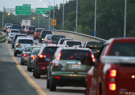
Cars leaving Ocracoke on a ferry Island arrive in Hatteras, N.C., Wednesday, Sept. 1, 2010. An evacuation of Ocracoke is underway as Hurricane Earl apAP – Cars leaving Ocracoke on a ferry Island arrive in Hatteras, N.C., Wednesday, Sept. 1, 2010. An evacuation …

RALEIGH, N.C. – Powerful Hurricane Earl spun toward the East Coast on Wednesday, driving tourists from North Carolina's vacation islands and threatening to bring damaging winds and waves all along the Atlantic seaboard through Labor Day weekend.

Visitors took ferries off of Ocracoke Island and were told to leave neighboring Cape Hatteras in North Carolina's Outer Banks, and federal authorities have warned people along the coast to be prepared to evacuate if necessary.

Earl's effect on the East Coast will depend on when it makes its expected turn to the northeast.

A later-than-expected turn could mean the storm's eye makes landfall on the extreme eastern tip of North Carolina as a Category 3 storm late Thursday or early Friday.

If that happens, hurricane-force winds also could reach New York's Long Island and Cape Cod in Massachusetts.

Even if it doesn't, dangerous rip currents likely to be felt from the Carolinas north.

Virginia's Gov. Bob McDonnell declared a state of emergency as a precaution, allowing the state to position staff and resources ahead of the storm. Emergency officials as far north as Maine urged people to have disaster plans and supplies ready.

Even the U.S. Navy was altering plans, hustling to get the USS Cole back in port in Norfolk, Va., before the bad weather arrived. The destroyer wasn't supposed to come home from a seven-month deployment until later this week.

In Virginia Beach, where more than 20,000 long-distance runners, their families and friends are due to arrive this weekend for the Dodge Rock 'n' Roll Virginia Beach Half Marathon, organizers were keeping a close eye on the weather, but few participants had backed out.

"This is definitely on our radar, but at this time it looks like Sunday's half-marathon will take place as scheduled," said Dan Cruz.

Earl was still more than 700 miles south-southeast of Cape Hatteras on Wednesday afternoon, with topsustained winds of 125 mph. It was on track to near the North Carolina shore late Thursday or early Friday and then blow north along the coast, with forecasters cautioning that it was still too early to tell how close the storm may come to land.

The National Weather Service issued a hurricane warning for much of the North Carolina coast and hurricane watches from Virginia to Delaware.

Not since Hurricane Bob in 1991 has such a powerful storm had such a large swath of the East Coast in its sights, said Dennis Feltgen, spokesman for the National Hurricane Center.

"A slight shift of that track to the west is going to impact a great deal of real estate with potential hurricane-force winds," Feltgen said.

The only evacuation orders so far affected parts of the Outer Banks, thin strips of beach and land that face theopen Atlantic.

Tourist cars, some with campers in tow, lined up for the first ferries of the day from Ocracoke to the mainland. Another car ferry connects to Hatteras, which has a bridge to the mainland and came under the second evacuation order a little later Wednesday morning.

The evacuation orders are called mandatory, but Julia Jarema, spokeswoman for the state Division of Emergency Management, said it doesn't mean people will be forced from their homes. Local law enforcement officials may do something such as going door-to-door and asking people who stay behind for information about their next of kin.

Emergency officials said they hoped Ocracoke's 800 or so year-round residents would heed the call to leave. But Carol Paul said she and husband Tom would stay put if the current forecasts hold. Only a direct hit from a stronger storm would drive them from the island where they've lived for seven years, running an antiques store.

"There's never been a death on Ocracoke from a hurricane, so we feel pretty comfortable," Carol Paul said as tourists departed on ferries and her husband, also a construction contractor, worked to board up the windows of clients' and friends' homes. "Everything here is made pretty much with hurricanes in mind."

___

http://news.yahoo.com/s/ap/tropical_weather

Associated Press Writers Martha Waggoner and Emery Dalesio in Raleigh; Jack Jones in Columbia, S.C.; Suzette Laboy in Miami; and Bob Lewis in Bristol, Va., contributed to this report.