Kamis, 03 Februari 2011

Badai Yasi Mulai Menerjang Queensland

Rabu, 02/02/2011 22:56 WIB
Badai Yasi Mulai Menerjang Queensland
BBCIndonesia.com - detikNews


Badai Yasi ditaksir menyamai Badai Katrina di New Orleans 2005

Badai Yasi ditaksir menyamai Badai Katrina di New Orleans 2005

Badai berkecepatan lebih dari 100km/jam mulai menerjang pesisir negara bagian Queensland, Australia itu.

Badai Yasi diprediksi sebagai badai paling berbahaya yang akan menerjang negara bagian tersebut.

Menurut perkiraan, Yasi akan sekuat badai Katrina yang memporakporandakan kota New Orleans pada tahun 2005.

Warga Australia di sana Queensland diperingatkan mereka sudah terlambat untuk mengungsi dari Badai Yasi.

Sebuah stasiun pemantau cuaca hancur.

Sebagian tiang listrik dan banyak pohon tumbang.

Sekitar 30.000 warga kota Cairns telah dievakuasi dari rumah mereka.

Pertambangan, jalur kereta api, pelabuhan telah ditutup.

KE PEDALAMAN

Para pejabat Australia menyatakan badai mungkin menerjang masuk ke pedalaman hingga beberapa ratus kilometer.

Kawasan yang sama masih berjuang untuk pulih dari dampak banjir besar bulan lalu.

Menteri Besar Queensland Anna Bligh mengatakan warga di kawasan pesisir yang diperkirakan akan terkena banjir mestinya sudah meninggalkan rumah mereka.

Koordinator bencana negara bagian memperingatkan warga bahwa mereka mungkin akan hidup sendiri hingga selama 24 ketika Yasi menerjang.

Waktu untuk bergerak dan mengungsi kini telah berlalu, kata Bligh.

Bligh menambah Yasi akan menjadi badai paling merusak yang pernah menimpa pesisir kita.

Warga semestinya berlindung di mana saja mereka berada, katanya.

Banyak orang khawatir Yasi lebih dahsyat daripada badai Tracy, yang menerjang Darwin menjelang Hari Natal 1974 dan menewaskan 71 warga.

Tracy masuk dalam badai kategori empat, sedangkan Yasi kategori lima.

Badai Yasi menyusul banjir paling dashyat dalam sejarah Queensland.

Banjir tersebut dipicu oleh rentetan badai tropis yang menerjang kawasan sejak akhir bulan November.

(bbc/bbc)

Rabu, 02 Februari 2011

Midwest buckles under storm, calls it a snow day

Midwest buckles under storm, calls it a snow day


A vehicle is stranded on Interstate 43 Wednesday, Feb. 2, 2011, in Grafton, Wi. The area is under a blizzard warning and some freeways were shut down.AP – A vehicle is stranded on Interstate 43 Wednesday, Feb. 2, 2011, in Grafton, Wi. The area is under a blizzard …
    By MICHAEL TARM, Associated Press 21 mins ago

CHICAGO – A massive storm billed as the worst in decades barreled toward the northeast Wednesday, leaving vast swaths from Chicago to New York paralyzed by snow and ice, leaving hundreds of motorists stranded all night and shuttering airports and schools.

Chicago received up to 19.5 inches of snow with more still possible, and Missouri as much as 1 1/2 feet. More than a foot dropped on northern Indiana and southeast Kansas, while Oklahoma saw as much as a foot.

Spots in northern New York already had gotten more than a foot of snow by Wednesday morning. New York City was expected to get up to three-quarters of an inch of ice by midday before the mix of sleet and freezing rain warms up to rain.

Forecasters warned ice accumulations could knock down some tree limbs and power lines across the storm's more than 2,000-mile path. Ice also could affect transit service, even as plow drivers struggled to keep up with the snow on many roads.

In New York, Mike Schumaker already was into his fourth hour of what he predicted would be a 24-hour plowing marathon as he cleared snow from a suburban Albany gas station around 5 a.m. Wednesday.

"I figure I'll be going to about 1 or 2 in the morning. That's my guess," said the 42-year-old private contractor from Latham.

"It's not so much about plowing as it is about to where to put it," he said. "We still have snow from Christmas that hasn't melted."

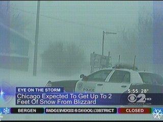
In Chicago, the city closed public schools for the first time in 12 years and shut down Lake Shore Drive, where hundreds of motorists were stranded for 12 hours after multiple car accidents on the iconic roadway.

Bulldozers moved snow away from an estimated hundreds of cars that remained buried up to their roofs Wednesday morning after drivers had been rescued. Only then could tow trucks move in. A shuttle bus sat abandoned with its door open, letting snow blow inside and build up on the driver's seat as the radio continued to transmit.

Raymond Orozco, chief of staff to Mayor Richard Daley, said crews' efforts to rescue motorists had been "severely hampered" by snow drifts, high winds and white-out conditions.

Jenny Theroux, 23, told the Associated Press she was stranded from 4 p.m. Tuesday until about 4 a.m. Wednesday. Stranded just 800 feet from an exit, she repeatedly called the city for information.

"It was a very stressful experience toward the end, especially not knowing what's going on," Theroux said, after abandoning her car. "I'm just very confused as to why it all transpired this way."

Not only was driving dicey, but flying in and out of Chicago's O'Hare International Airport — a major U.S. hub — won't be possible until Thursday. The decision by O'Hare-based airlines to cancel all their flights for a day and a half was certain to have ripple effects at other U.S. airports, said transportation expert Joseph Schwieterman.

"Effectively shutting down America's most important aviation hub hits the system immeasurably hard," he said of O'Hare. The city's smaller airport, Midway International, had hoped to resume flights Wednesday afternoon.

By 9:30 a.m., the nation's airlines had cancelled more than 5,200 flights — or more than 16 percent of the day's scheduled traffic, according to flight-tracking service FlightAware.com. That came a day after airlines grounded 12,630 flights due to the storm.

More than 200,000 homes and businesses in Ohio began Wednesday without power, while in excess of 100,000 customers had no electricity in New Jersey and Pennsylvania, which were hit with mostly freezing rain and ice. Rolling blackouts were in Texas, including Super Bowl host city Dallas.

Outside the Philadelphia Museum of Art, a crew preparing to clear ice from the city's sidewalks sat in their van warming up before sunrise Wednesday.

One complained that getting to work — even for him — had been treacherous.

"Walking was terrible," said Rob Jones, 20, of Cenova Snow & Ice Solutions "I slid all the way down my street."

Federal Emergency Management Agency director Craig Fugate said the agency is on standby with generators, food, water and other supplies to help state and local authorities.

"The real heroes are these local responders going out in the storms and still rescuing people," he told ABC's "Good Morning America."

In Oklahoma, rescue crews and the National Guard searched overnight for any motorists who might be stranded along its major highways after whiteouts shut down Tulsa and Oklahoma City.

For those who insisted on braving the elements, the risks were many. "If you don't have enough fuel in your vehicle, you can run out, the heat goes out — and people can even freeze to death," said Greg Cohen, executive director of the Roadway Safety Foundation.

The storm's powerful punch came from cold air that swept down from Canada, clashing with warm, moist air coming up from the south, explained National Weather Service meteorologist Gino Izzo.

The most dramatic illustration could be seen earlier this week in Texas, when one part of the state reported temperatures in the single digits and another part had temperatures in the 70s with near tropical humidity, Izzo said.

"That was the breeding ground for this storm," he said.

Cities across middle America shut down hours ahead of the snow. Scores of schools, colleges and government offices canceled activities or decided not to open at all. Thousands of flights were canceled across the nation.

The NFL did manage to stick to its Super Bowl schedule, holding media activities at Cowboys Stadium in suburban Arlington as planned, though the city's ice-covered streets were deserted.

Even Chicago — with its legions of snowplows and its usual confidence in the face of winter storms that would surely crush other cities — bent under the storm's weight.

"This is nothing to play with here," said Edward Butler, a lakefront doorman peering through his building's glass doors at snow blowing horizontally and in small cyclones down the street. "This is gale force wind."

The wind gusts were strong enough to start the building's heavy revolving door spinning by itself.

Many businesses in the city planned to remain shuttered Wednesday, as did cultural attractions and universities.

Some parents were glad the city took the rare step of closing schools in a city that is normally proud of shouldering the worst Mother Nature has to offer.

"They should cancel," said Sunjay Shah, 54, a sundries shop manager stranded at a downtown hotel overnight, saying his 17-year-old son was thrilled with the snow day. "How are students going to walk or take trains (to class)?"

Providing a ray of hope to those battered by the storm, the world's most famous weather forecaster — with four legs — predicted an early spring.

Punxsutawney Phil's handlers told Groundhog Day revelers at Gobbler's Knob, a tiny hill in Punxsutawney, Pa., that the groundhog had not seen his shadow, meaning winter will end within six weeks, according to tradition.

___

Associated Press writers Karen Hawkins, Don Babwin, Sophia Tareen, Tammy Webber and Barbara Rodriguez and photographer Kii Sato in Chicago; Tom Coyne in South Bend, Ind.; Dinesh Ramde in Milwaukee; Ken Miller in Oklahoma City; Patrick Walters in Philadelphia; Chris Carola in Albany, N.Y.; Jim Salter in St. Louis; and Justin Juozapavicius in Tulsa, Okla., contributed to this report.

http://news.yahoo.com/s/ap/us_winter_weather

Powerful cyclone strikes Australia's northeast

Powerful cyclone strikes Australia's northeast


Guests at a the Shangri-La hotel huddle in the ballroom in Cairns, Australia, Wednesday, Feb. 2, 2011, as a monster cyclone approaches the northeast cAP – Guests at a the Shangri-La hotel huddle in the ballroom in Cairns, Australia, Wednesday, Feb. 2, 2011, …

CAIRNS, Australia – A massive cyclone crashed into northeastern Australia on Thursday, ripping roofs from buildings and cutting power to thousands of homes but leaving the scale of disaster unknown as officials and residents holed up while the tempest raged.

The Bureau of Meteorology said the destructive core of Cyclone Yasi hit the coast a few minutes after midnight at the small resort town of Mission Beach in Queensland state. Dozens of other cities and towns in the region — known to tourists worldwide as the gateway to the Great Barrier Reef — were being battered by heavy rain and winds forecasters said could reach gusts of 186 mph (300 kph).

Witnesses reported seeing roofs ripped off, buildings shaking and trees flattened under the power of the winds. Officials said the storm would cause the sea to surge inland and flood some places to roof level.

The storm will compound misery in Queensland, which has already been hit by months of flooding that killed 35 people and inundated hundreds of communities. The storm struck an area north of the flood zone, but the weather bureau said it would bring drenching rains that could cause floods in new parts of the state.

More than 10,000 people fled to some 20 evacuation centers set up in a danger zone stretching some 190 miles (300 kilometers), amid strong warnings in the past two days. Many others moved in with family or friends in safer locations. Still, authorities were preparing for devastation, and likely deaths.

The storm's front was about 300 miles (500 kilometers) across, and the worst of the winds were expected to lash the coast for up to four hours, although blustery conditions and heavy rain could last for 24 hours.

"This is a cyclone of savagery and intensity," Prime Minister Julia Gillard said in a nationally televised news conference as the storm moved toward the coast. "People are facing some really dreadful hours in front of them."

The damage would not be known until first light, officials said.

In the city of Cairns, about 75 miles (120 kilometers) north of Mission Beach, dozens of guests at a waterfront hotel took cover in the central ballroom as lights flickered. Staff members pinned curtains shut over windows that were in danger of shattering and handed out flashlights.

Tourist Barbara Maskei, 49, of Germany, lay on the ballroom floor under a sheet reading a book, as her 20-year-old daughter, Annette, and husband, Peter, dozed beside her. For her, there would be no sleep. "I like to keep my eyes open," she said as the wind roared outside.

Staff attempted to distract people from the storm roaring outside by playing the movie "Music and Lyrics" on a giant screen. Some people attempted to sleep through the noise of the movie, wailing children and loud conversations about everything from cricket to the storm.

In Innisfail, a town about 55 miles (90 kilometers) south of Cairns that is nearly in the direct path of the storm, Mayor Bill Shannon said he saw the roof torn off a building near the local government building where some 500 people are sheltering.

"We're just hoping and praying we can all get through the night," Shannon said.

In nearby Tully, resident Ross Sorbello described feeling his house shake from the wind.

"The wind and rain outside are howling; it's a horrible sound," he said.

Storm surges of at least 6.5 feet (2 meters) were likely and would almost certainly flood some coastal communities, the Bureau of Meteorology said, adding that up to 28 inches (700 millimeters) of rain could fall within hours in some areas.

At highest risk was an area about 150 miles (240 kilometers) long between Cairns and the sugar cane-growing town of Ingham, the bureau said. The storm was forecast to continue inland at cyclone strength for two days, though gradually weakening. It was unclear what the damage to the Great Barrier Reef would be, experts said.

State disaster coordinator Ian Stewart said just one emergency call had been received — from six people in their 60s who feared their apartment in the resort town of Port Hinchinbrook would be swamped by the storm surge. They were told it was too dangerous for emergency workers to try to reach them, and they would have to wait it out, Stewart said.

Winds knocked out power to about 90,000 homes, a number expected to rise.

Still, many in the storm's path were stoic. Cairns resident Jane Alcorn banned those who planned to shelter with her in the garage of her apartment complex from panicking.

"There's no crying, no hysterics," said Alcorn, 42. "It's going to be loud, it's going to be scary. But we've got each other."

Queensland officials warned people for days to stock up on bottled water and food, and to board or tape up their windows. People in low-lying or poorly protected areas were told to move in with family or friends on safer ground or go to evacuation centers.

"It's such a big storm — it's a monster, killer storm," Queensland Premier Anna Bligh said, adding that the only previous storm measured in the state at such strength was in 1918. "This impact is likely to be more life threatening than any experienced during recent generations."

More than 10,000 people took shelter in 20 evacuation centers, including one set up in a shopping mall in downtown Cairns, a city with a population of 165,000. People huddled in hallways with blankets, camping chairs and snacks.

On Wednesday, police told people to get off Cairns' streets. "Everyone's gotta go now," one officer told pedestrians strolling near the waterfront. "The water is coming NOW."

Warnings stretched as far away as Townsville, which is slightly larger than Cairns and about 190 miles (300 kilometers) to the south, and Mount Isa, about 500 miles (800 kilometers) inland.

People were told to move to rooms at the center of their houses — usually the bathroom — as they were structurally safest and usually had no windows. People should bring mattresses and other items to hide behind in case of flying debris, sturdy shoes, and raincoats in case roofs are ripped off.

Carla Jenkins, 23, of Cairns, packed a suitcase, taped the windows of her house and fled to her grandmother's sturdier apartment complex with her sister and her dog, Elmo. The women had candles, flashlights, water and canned food, and planned to spend the night huddled in a bathroom away from the windows.

"I can't see many Cairns people sleeping tonight," she said. "Tonight's going to be a very scary night."

Australia's huge, sparsely populated tropical north is battered each year by about six cyclones — called typhoons throughout much of Asia and hurricanes in the Western hemisphere. Building codes have been strengthened since Cyclone Tracy devastated the city of Darwin in 1974, killing 71 in one of Australia's worst natural disasters.

___

Online:

Bureau of Meteorology: http://www.bom.gov.au/cyclone/index.shtml

http://news.yahoo.com/s/ap/20110202/ap_on_re_as/as_australia_storm


Flood-weary Australians flee new, 'monster' storm

Flood-weary Australians flee new, 'monster' storm


FILE - In this file photo taken Thursday, Jan. 13, 2011, two local residents walk through floodwater after getting ice and food to take to their floodAP – FILE - In this file photo taken Thursday, Jan. 13, 2011, two local residents walk through floodwater …

CAIRNS, Australia – Thousands of people fled from the path of amonster storm bearing down on northeastern Australia that officials warned Tuesday was almost certain to cause widespread damage and could turn deadly in a state still suffering from massive floods.

Hospitals in the tourist gateway of Cairns emptied as military evacuation flights ferried the ill and elderly to safety far south from a long stretch of Queensland state's tropical coast that are in the path of Cyclone Yasi. Residents packed onto extra commercial flights added to allow them to leave.

The Cairns airport was scheduled to close Wednesday as Cyclone Yasi approaches.

"We're in the process of packing up boxes ... the dogs and the pet snake and getting out of here," Cairns resident Melissa Lovejoy told the Australian Broadcasting Corp. She said the family decided to leave their home near the coast for a friend's place that was sturdier and further inland after getting phone call and a text message warning residents to evacuate by Tuesday night.

Cyclone Yasi was forecast to hit the coast late Wednesday or early Thursday with wind gusts of around 155 miles per hour (250 kilometers per hour), the Bureau of Meteorology said.

Carla Jenkins, a 23-year-old Cairns resident and flight attendant, was feeling jittery as her plane coasted to a halt at the Cairns airport Tuesday night. Jenkins lived through Cyclone Larry, which slammed into the region in 2006, and feared Yasi would be even more brutal.

"One of the scariest things I remember (from Larry) was on the radio, they said, 'Fear for your life,'" said Jenkins, who was planning to ride out the storm in her house. "I've got a feeling this is going to be worse. So I'm just a bit freaked out."

Forecasters said up to three feet (one meter) of rain could fall on some coastal communities. Many parts of Queensland state are already saturated from months of flooding, though the worst floods hit areas hundreds of miles (kilometers) farther south of the towns in the immediate path of Yasi. Still, Queensland Premier Anna Bligh said residents up and down the coast needed to prepare.

"It's such a big storm — it's a monster, killer storm — that it's not just about where this crosses the coast that is at risk," Bligh said.

"I know many of us will feel that Queensland has already borne about as much as we can bear when it comes to disasters and storms," she said. "But more is being asked of us."

Cairns, a city of some 164,000 people and a gateway for visitors to the Great Barrier Reef, was in the path to bear the brunt of the storm. But wind warnings of various degrees of strength were issued for a stretch of coast some 1,000 miles (1,600 kilometers) long, from the remote community Cape Melville to the port city of Gladstone.

In Cairns, more than 9,000 people in low-lying and coastal parts were ordered to evacuate their homes as the sea is expected to surge at least 6.5 feet (two meters) and flood significant parts of the city.

The military was airlifting 250 patients from the waterfront Cairns Base and Cairns Private hospitals to Brisbane, the state capital about 1,000 miles (1,700 kilometers) south. Elderly care homes were also being evacuated.

"In reality, we would like people to get as far south as possible, as quickly as possible, without of course breaking the rules," said Ian Stewart, the state's disaster coordinator, told reporters.

Airlines were arranging extra flights Tuesday night. Tourists who had been evacuated from beach resorts — ranging from backpacker hostels to exclusive clubs sometimes frequented by Hollywood stars, and once by a vacationing President Bill Clinton — were flying out.

Another storm, Cyclone Anthony, hit Queensland early Monday but quickly weakened and did little more than uproot some trees and damage power lines. Forecasters said Yasi had a storm front more than 310 miles (500 kilometers) wide and was far larger and more powerful than the earlier storm, so it could reach far inland before it significantly loses power.

Queensland has been in the grip of one of Australia's worst natural disasters for more than a month. Tropical deluges that began in November flooded an area greater than France and Germany combined, damaging or destroying some 30,000 homes and businesses and killing 35 people.

Large parts of Brisbane, Australia's third largest city, were inundated for days. The government says the total cost to Australia is at least 5.6 billion dollars.

Yasi's forecast path is farther north, sparing Brisbane and towns worst-hit by the past floods. Still, Bligh said the storm's path could change and everyone near the coast should prepare.

Australia's huge, sparsely populated tropical north is battered by about six cyclones — called typhoons throughout much of Asia and hurricanes in the Western hemisphere — each year. Building codes that have been strengthened since Cyclone Tracy devastated the city of Darwin in 1974 have left the region generally well-prepared.

In 2006, Cyclone Larry tore through the rural community of Innisfail, about 60 miles (100 kilometers) south of Cairns, destroying thousands of homes and devastating banana and sugar cane plantations. No one was killed.

Stewart said residents in Yasi's path should be prepared with flashlights, food and water.

"Please make no mistake: This storm is a deadly event," Stewart said. "Now is the time to act."

In Cairns, residents stocked up on food and supplies ahead of the storm.

Mayor Val Schier said some people were running behind with their preparations, despite the warnings.

"Some people have left it very late," she said. "They were complacent and didn't heed the warnings."

___

Online:

Bureau of Meteorology: http://www.bom.gov.au/cyclone/index.shtml

http://news.yahoo.com/s/ap/20110201/ap_on_re_as/as_australia_storm